 |
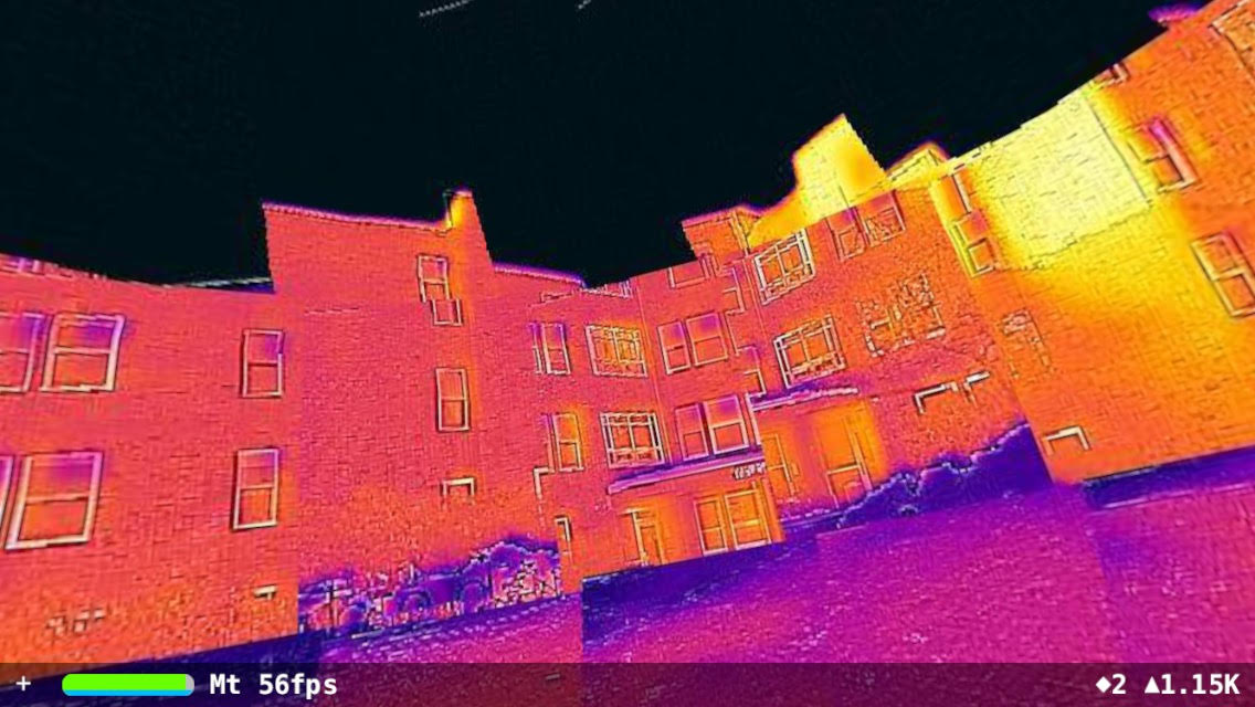
| An infrared street view |
 |
| An infrared image sphere |
The Infrared Street View project is based on infrared cameras that work with now ubiquitous smartphones. It takes advantages of the orientation and location sensors of smartphones to store information necessary to knit an array of infrared thermal images taken at different angles and positions into a 3D image that, when rendered on a dome, creates an illusion of immersive 3D effects for the viewer.
The project was launched in 2016 and later joined by three brilliant computer science undergraduate students, Seth Kahn, Feiyu Lu, and Gabriel Terrell, from Tufts University, who developed a primitive system consisting of 1) an iOS frontend app to collect infrared image spheres, 2) a backend cloud app to process the images, and 3) a Web interface for users to view the stitched infrared images anchored at selected locations on a Google Maps application.
The following YouTube video demonstrates an early concept played out on an iPhone:
No comments:
Post a Comment